Part one
The trip got away from the newly re-opened BP at “The Lakes” more or less on time with stops for lunch and afternoon tea. The turn off at Boorabin was easily found and we made our way towards Jaurdi homestead as the daylight faded. Once at the railway line, we turned right and started looking for the crossing across the railway line to take us to Wallaroo rock to meet Kim and Lynn. After some looking around in the dark, we proceeded down a track next to the railway line rather than the main road. We finally found the correct road, only to lose Doug and Helen and Alan and Wendy at a bend. This enabled Dave and Tammy to catch up with us as they had left Perth after us. We got to our rendezvous at Wallaroo rock with Kim and Lynne in time to set up and sit around a very welcome camp fire.
On Friday morning we explored the rock, with its large pool of water (mozzies and flies) while Steven and Karen went to Kambalda to take some supplies to Nathan. After leaving we followed the railway road until we were just North of Coolgardie. In Kalgoorlie we headed for the BP truck stop for fuel etc before heading off. Yarri road was easily found (just follow a lot of trucks) and we followed this up to Donkey Rocks road. We let our tyres down as it was fairly rough – so rough that we decided to turn around to find a different route. Just as well because after re-reading the notes from the Wanneroo Wanderers we found that the road disappeared. We headed further north and turned into Pianto road. This was more pleasant with only a few minor challenges.
We couldn’t find the soak that was mentioned, however we did find an old well. From here we turned north to look for Donkey Rocks. With the use of a combination of GPS and paper maps, we got very close but decided to camp for the night before visiting.
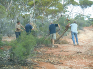
 Saturday saw Dave exploring the route to get to the rocks and clearing a lot of broken glass off the track. The rocks were very interesting and there was much speculation as to the reason for their name. From here we headed north and then east back towards Yarri road (via Cranky Jack rd)! Alan and Wendy had been having overheating problems and opted to head back into Kalgoorlie to sort out the problem and the rest of us headed for Pinjin station. We called in to see the caretaker as requested. He explained that all the roads around there had been altered and led us down a track till we reached the Nippon hwy/mine road. Again we headed East and followed the mine road to a cross road which took us to the Nippon hwy and then on to the road to the Springs. The recent rain had made the plants look really green. We were all staggered by the clumps of bright green Spinifex. We missed the turn off to Streich mound as it was not marked and had not been used for a while and camped close to the Springs (mozzies, midgies and flies) and enjoyed yet another campfire.
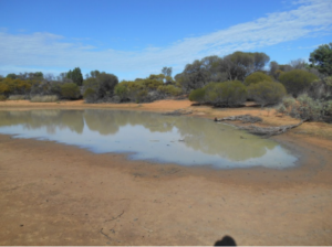
 On Sunday we found water in the Queen Victoria Springs. Last time some of us visited it was dry, however there has been a fair amount of rain in the area recently. We didn’t think that we would have made it the week before as the tracks had obviously been running like creeks. There were lots of footprints around the Springs. After finding a geocache, we headed for Cundeelee mission which had been abandoned. This road had had a severe fire recently and there was also some track clearing to do. We spent some time here wandering around and Gerry spent the time pumping fuel from our sub tank into a Jerry can and then into the main tank as our pump had failed. We said farewell to Kim, Lynn, Dave and Tammy as they were heading for Zanthus.
The rest of the convoy headed down the Permit road as the trip leaders fuel situation was tight. We crossed
a river bed with water in it – not deep and kept heading South to the Trans line. As we were pumping
up our tyres, the others caught up with us. They had not been able to cross the river on their track as it was soft and wide. We said farewell again and the group headed back to Perth.
Part two
Kim, Lynn, Dave and Tammy heading to Zanthus.
On Sunday after lunch at the abandoned Cundeelee Aboriginal Community we left Gerry and the group and headed South East on the track to Zanthus. We only got about 10k’s to Ponton Creek where the crossing had been severely washed away with an impassable 10ft high embankment on the other side. We investigated a possible detour along the creek through some soft mud and some bush bashing to get back to the main track but decided it was less risky to back track and head South on the track Gerry and the others had taken. Eventually we caught up with the tail end of the main group who had then headed West toward Kalgoorlie.
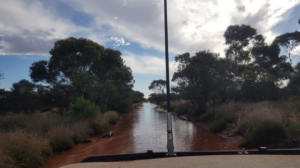
 We headed East along the Trans Australian Railway Access Road toward Zanthus. The road was flooded just after Zanthus but luckily there was a short detour and we continued along for about 20kms before making camp right next to a long straight stretch of the rail line. Any closer and the train driver would have been able to lean out and take the beer out of Kim’s hand and it wasn’t long before a 1.8km long train was thundering down the line towards us with horns blasting away. Kim got up to see all 4 trains during the night including the Indian Pacific at 3.45am which Kim says was spectacularly impressive with all the dining cars lit up. We travelled North on the Cable Haul Road (mostly a track) to the Plumridge Lakes Nature Reserve. We
passed many abandoned cars along the way and also a white steel cross with only a name ‘Jarman Woods’ (no dates) on it. When Kim had mobile phone coverage he researched who Jarman Woods was and found that 10 years ago a 69 year old Aboriginal artist Nyakul Dawson and his 45 year old nephew (Jarman Woods) had both died here after their vehicle had a flat tyre. You can read the full story here: http://www.theaustralian.com.au/news/nation/how-a-simple-flat-tyrekilled-artist-and-bushman/news-story/553e7cd031e5de861385afec288a9eb6
We continued North through the sand ridges and as we neared the Plumridge Lakes Reserve the track deteriorated into 2 wheel tracks through spinifex that was hard to follow and meandered through thick bush. We couldn’t find the camp site that was on our GPS and supposedly near the Gwynne Creek so we ended up camping in a bush clearing with disappointingly, no water in sight! The next day we continued North to Lake Rason through lots of water along the track. Along the way we came across a mob of camels and we also saw a dingo, emus and kangaroos.
 At the Western end of the lake there was a sizeable tin shack that had been built in 1992 (and rebuilt a few times after storms). As we approached the shack we heard loud music thumping and when we pulled up a guy came over to chat. He (Darryl) explained the history of the “7 Millers Club” shack (that he had built) and that he and mates had been coming to the area prospecting and shooting since 1992 (7 Millers referred to 7 millimetre rifle shells).
Darryl was with his nephew and they were well equipped with large purpose built and modified quad bikes with winches, rifle holders and spare fuel. They had shooting targets out on the dry lake bed 800m and 1km away that they accessed with the quads. They also went out shooting camels and feral cats but he assured us the guns had been locked away for the night!
We were welcomed to look through the shack and to help ourselves to the substantial supply of fresh water in the fairly new poly water tank. The shack was used as base by emergency services for the search for 62 year old Reg Foggerdy in October 2015 who had become lost whilst shooting in the area and very lucky to be found alive by an aboriginal tracker. He survived for 6 days without water by eating ants – you can read the story about Reg here:
http://www.perthnow.com.au/news/westernaustralia/health-of-miracle-outback-survivor-regfoggerdy-deteriorates/newsstory/81eaa3a4cb81e1a825778a80184936ae

Great camp spot at Lake Rason where we were enjoyed a spectacular evening lightning show.
The next day we headed West towards Laverton 180k’s away. The track was flooded in sections and some detours (wheel tracks) had been pushed through the bush.
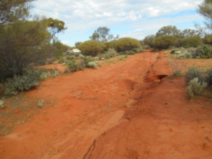
 The track to Laverton took us through sand dunes and some great break away country. The last 56km into Laverton was along a nice wide mine service road but it had some major washaways due to the rain. We arrived in Laverton to learn that a couple that had been out in the area we had been and had got seriously bogged in mud and set off their epirb to be rescued. We stayed overnight in Laverton and enjoyed hot showers and some pub grub.
The next day we headed to Lake Ballard via the remains of the historic townsite Malcolm. The recent rains had made walking out on the lake very muddy. From Lake Ballard we headed South via the Coolgardie North Road and West to our last night’s camp off the Mount Palmer track near Yellowdine. We arrived back in Perth on Saturday the week after Easter. We were lucky with the weather (no rain), no mechanical issues or flat tyres and enough water and fuel to get us back to Laverton okay.

